Washington Reads (Fall 2005) - Geology of Washington State
The geologic and geographic features of Washington enchant and amaze us by their sheer magnitude, diversity and beauty. From the scablands to the volcanic Cascades, the varied terrain of the Northwest has fascinated and attracted both the serious geology student and the curious who live or visit in the state. Washington’s geology is the result of a captivating history beginning about two billion years ago according to scientists. The Washington Reads collection for fall 2005 spotlights how geologic events have contributed to Washington’s intriguing and diverse features.
| ADULT |
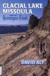 |
Alt, David. Glacial Lake Missoula and Its Humongous Floods.
Lake Missoula, an enormous Ice Age lake, drained repeatedly and helped to shape the geology of much of the Northwest. This book is written by following the path of the flood waters from Western Montana across the Idaho Panhandle, eastern Washington, and through the Columbia Gorge to the Pacific. With black-and-white photos and useful, understandable maps, this book is ideal for the “armchair scientist.”
|
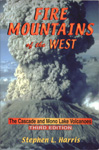 |
Harris, Stephen L. Fire Mountains of the West.
This historical account of potentially devastating volcanoes spanning from British Columbia to California is a completely revised and well-researched. Each major volcano in the West is profiled in a separate chapter, with descriptions of the processes that created the scenery. Information and directions are included on how readers can enjoy each mountain, whether they are on foot, in a car, or climbing to the summit.
|
| YOUNG ADULT |
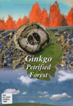 |
Orsen, Mark. Ginkgo Petrified Forest.
Vantage, Washington is home to one of the world’s most interesting petrified forests. The small, windswept town on the Columbia River was once a lush wooded area. Over a span of sixteen million years, the Ginkgo Petrified Forest was formed by geological forces. Volcanic eruptions, buckled mountains, mile-thick glaciers and massive dams of ice shaped the landscape. Photos, maps, illustrations, and a glossary bear witness to this powerful geological story.
|
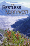 |
Williams, Hill. The Restless Northwest.
Retired Seattle Times Science Writer, Hill Williams, presents a straight-forward and lucid discussion of the geologic activity that shaped the scenery of the Pacific Northwest. Designed for the casual reader, he explains complex processes in a conversational style. The book is enhanced with black-and-white photos, a Pacific Northwest Geological Almanac, and a Glossary of Geological Terms.
|
| CHILDREN |
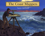 |
Morrison, Taylor. The Coast Mappers.
In 1850, before radar and satellites, George Davidson was asked to measure and chart the entire Pacific coast of the United States. This book chronicles the many adventures and enormous challenges, made worse by the lack of maps to help in treacherous waters. This is a well-illustrated history of both map making and exploration in the Pacific Northwest.
(Ages 9 – 13)
|
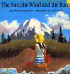 |
Peters, Lisa Westberg. The Sun, Wind and the Rain. Illustrations by Ted Rand.
Elizabeth builds a mountain from wet sand and in the process the reader learns about the formation and evolution of a mountain. The information is simple and scientifically accurate. Each two-page spread represents a stage in the development of a mountain; the left page describes a mountain and the right page describes Elizabeth’s work on her sand mountain. Through vivid watercolor paintings, the forces of sun, wind and rain that shape a mountain are highlighted. (Ages 4 – 7)
Cover illustration by Ted Rand. Copyright 1988 by Ted Rand. Reprinted courtesy of Henry Holt and Company.
|