Capitol Lake: Beauty and controversy
In the midst of summer, people in the Olympia area seem to flock to Capitol Lake. The lake, which sits at the mouth of the Deschutes River at the edge of downtown Olympia, provides a scenic 1.5 mile loop with an amazing view of the state capitol buildings. The trail attracts walkers, runners, bikers, dogs, children, skaters and even the occasional unicycle. Of course, the trail around the lake is open year round, but several activities are hosted in the summertime. Capital Lakefair, an Olympia tradition that takes place every year in July, just wrapped up their 57th celebration a few weeks ago. Every night from June through mid-August, people also enjoy walking the loop around the lake at dusk, when thousands of bats can be seen feeding on insects over the lake. Most of the bats are pregnant, and they commute 16-20 miles round trip every night from Woodard Bay in North Olympia. The typical bat species that visit the lake are the Yuma Bat, Little Brown Bat, California Bat, Silver-haired Bat and the Big Brown Bat. As some people may know, Capitol Lake is actually not a lake, but rather a shallow reservoir created by damming the Deschutes in 1951. This was a result of a state Legislature decision that was almost 15 years in the making. In July of 1948, an article in the Daily Olympian indicated that the area was an “eyesore,” that would be “replaced with a clear beautiful freshwater lake with mirrored reflections of the Capitol Building dome.” Capitol Lake is currently facing a variety of challenges, including water quality, invasive species, and sediment management. Because of these issues, the Capitol Lake Adaptive Management Plan (CLAMP) Steering Committee has researched and considered four alternatives for the future of the lake. These alternatives are keeping the status quo; managing the lake, where the committee will restore the depth of the lake and then periodically dredge the new sediment coming down the river; creating an estuary, by dredging the sediment, removing the dam and constructing a new 5th Avenue Bridge; and creating a dual basin estuary, which is the same as the estuary alternative but with a barrier dividing part of the lake into a saltwater reflecting pool. The alternative futures have sharply divided the community and no scenario has gained the upper hand. The Legislature will be asked to finance dredging, but that doesn't resolve the larger issue. Although Capitol Lake may change in the future, it will always remain an icon of Olympia and one of the best trails around.
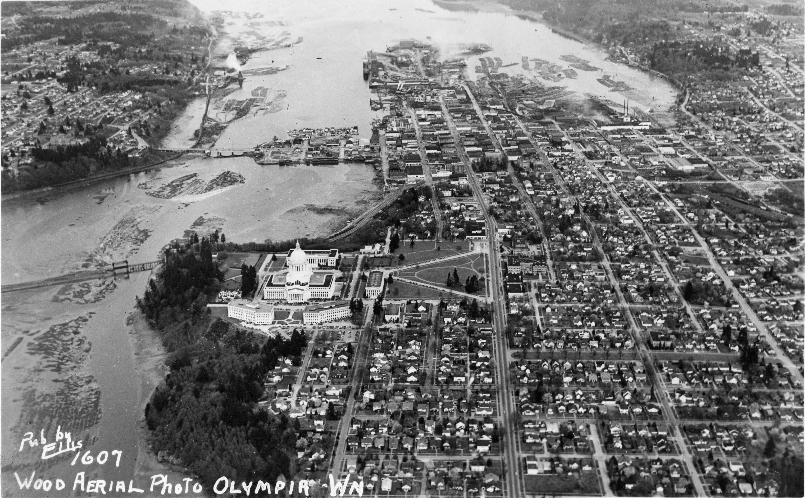
An aerial view of Olympia taken sometime between 1928 and 1940, before the dam was built. (Photo courtesy of WA State Archives)
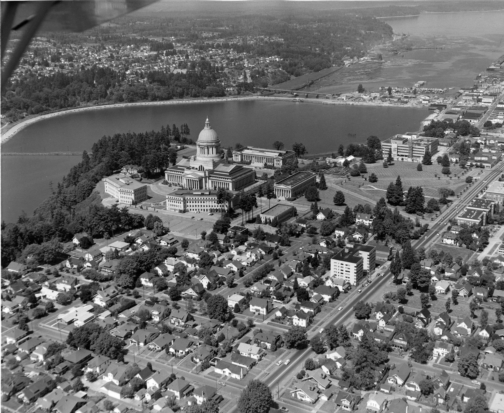
An aerial view of Olympia, taken in 1955 after the dam was built. (Photo courtesy of WA State Archives)

The view of Capitol Lake from the Capitol Campus. (Photo courtesy of Katy Payne)

This was taken from the Capitol Lake trail, and the Lakefair ferris wheel is in view behind the lake. (Photo courtesy of Janet Lee)
(html)
Secretary of State
Steve Hobbs
